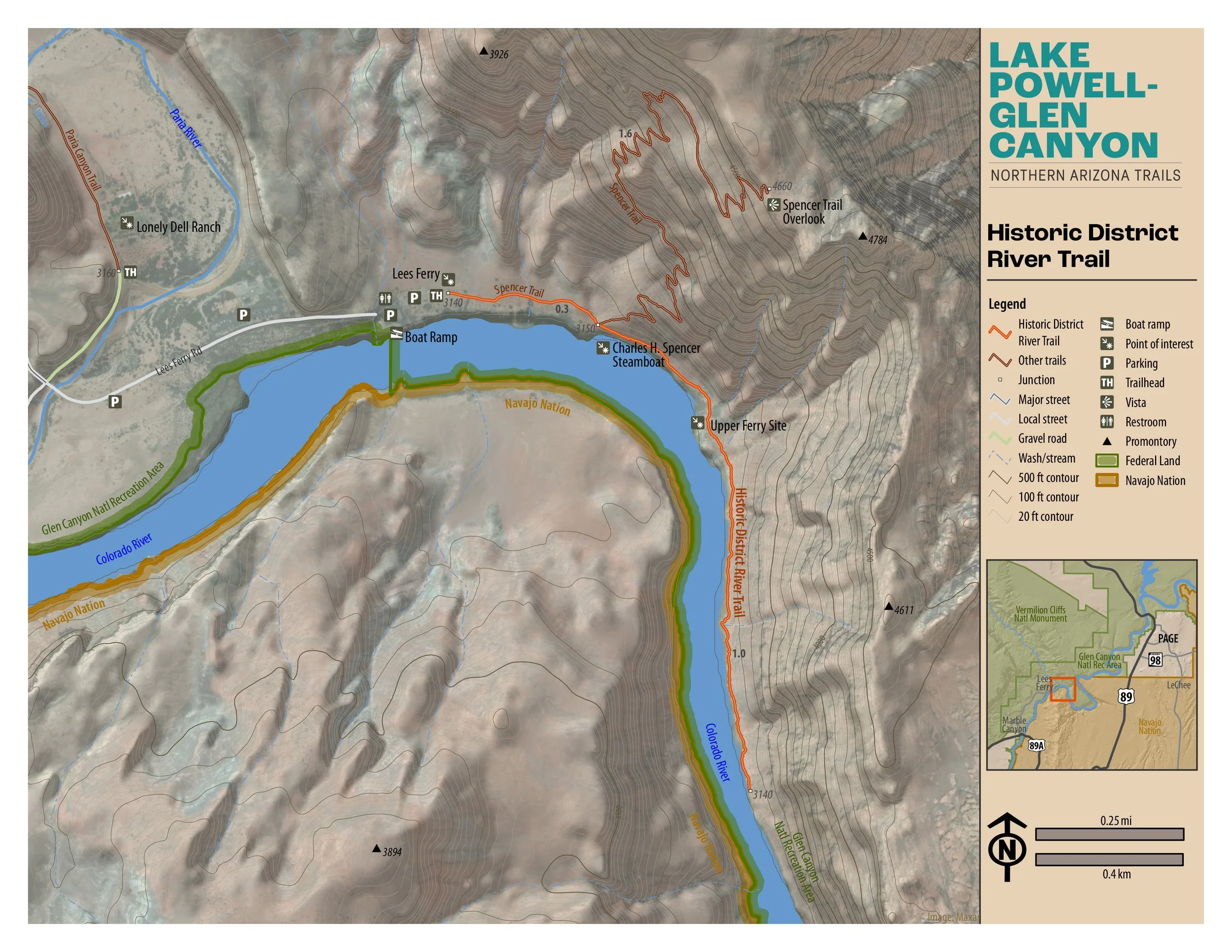
Historic District River Trail
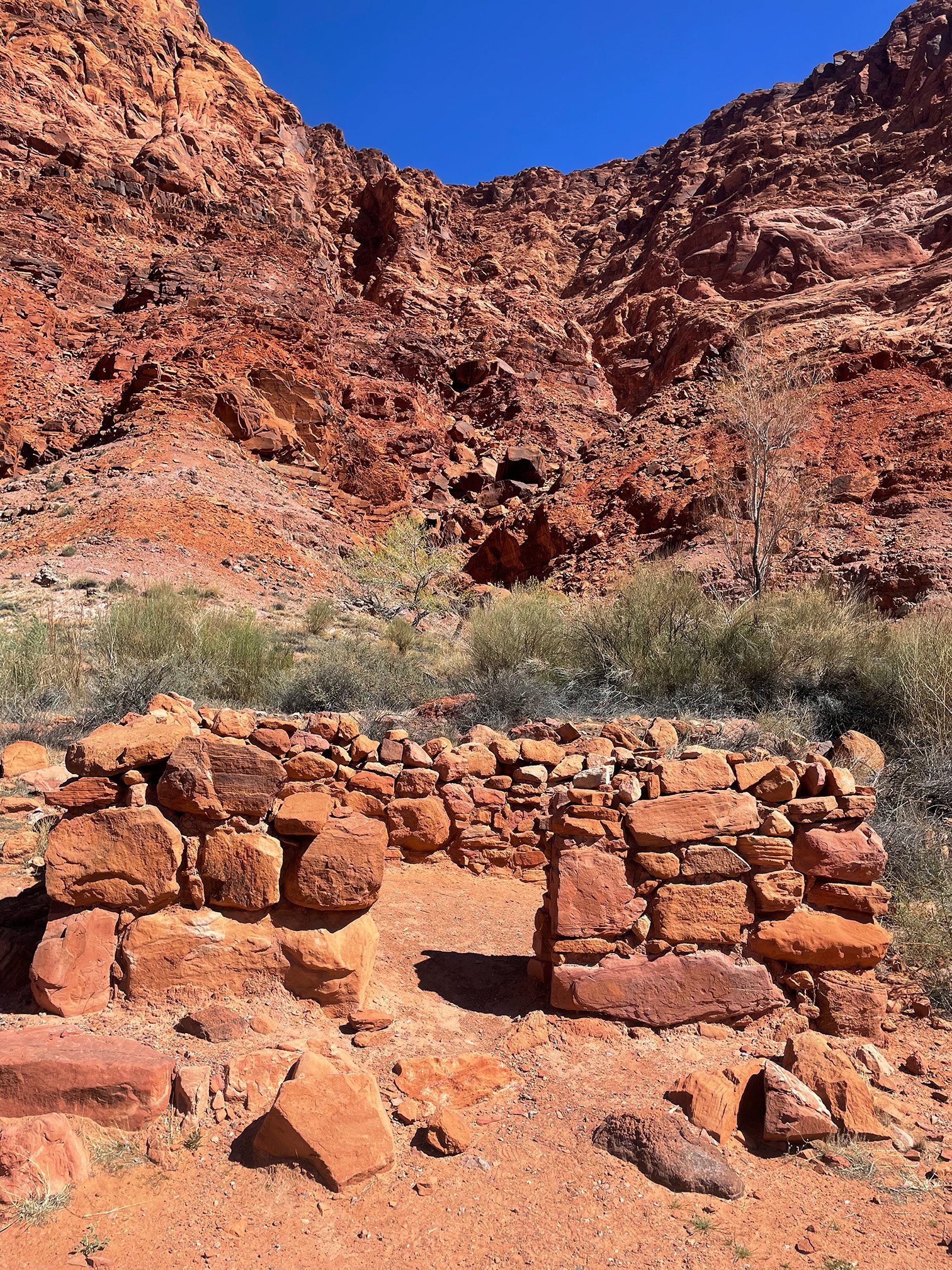
“An easy 2-mile out and back trail along one of the most scenic rivers in the southwest, the Colorado. Signage speaks to historical buildings, operations, and the people that built them.”

Easy
1.86 miles (3.0 km)
Hiking
This easy 2-mile out and back hike in the Lees Ferry area is on hard packed earth and features some rock steps. Turn around at the loop at .93 miles. The trail continues from the loop approximately .3 miles but is not maintained. Beautiful river views with several historical signs.
GET THE APP. GET THE MAP.®
Download the Avenza Maps App and create an account. It’s free!


Directions
From the intersection of Lake Powell Blvd. and North Navajo Drive in Page the trailhead is 45 miles (72.42 km). Drive northwest on Lake Powell Blvd. and turn left (south) on HWY 89. At mile 25.2 turn right (north) on HWY 89A toward Lees Ferry and Jacob Lake. Cross over Navajo Bridge and at mile 39.3 turn right (north) onto Lees Ferry Road. There is a kiosk for the park entrance fee at mile 39.8. The trailhead is 5.2 miles north.
Click map below to navigate to trailhead.
Trail Details
Trailhead Coordinates: 36°51.9908'N 111°35.1225'W
Trail Access: National Park Service, U.S. Fee Area
Trail Surface: Hard packed earth, rock
Trail Condition: Fully developed
Trail Use Type: Hiking
Best Season: Year round, prepare for heat in summer
Parking at Trailhead: Yes
Restroom / Water: Yes
Pet Friendly: Yes, leash required for pets
Degree of Difficulty: Easy
Trail Type: Out and back
Trail Length: 1.86 miles (3.0 km) out and back, .93 mile (1.5 km) one way
Elevation Gain / Loss: 24 ft
Elevation at Trailhead: 3144 ft
Cell Service: Intermittent
Land Manager: National Park Service (NPS) - Glen Canyon National Recreation Area (GCNRA)